OceanOPS
Monitoring and Supporting Global Ocean Observing Networks
OceanOPS is a global coordination center that monitors and supports the implementation, operation, and data flow of ocean observing networks, including OceanGliders, Argo, OceanSITES, and other GOOS components. It provides real-time tracking, data management, and reporting services to ensure the efficiency, sustainability, and visibility of global ocean observation efforts. By collaborating with scientific institutions, operational agencies, and stakeholders, OceanOPS plays a key role in enhancing data accessibility, interoperability, and long-term ocean monitoring to support climate research, marine ecosystems, and operational oceanography.
Monitoring OceanGliders Network
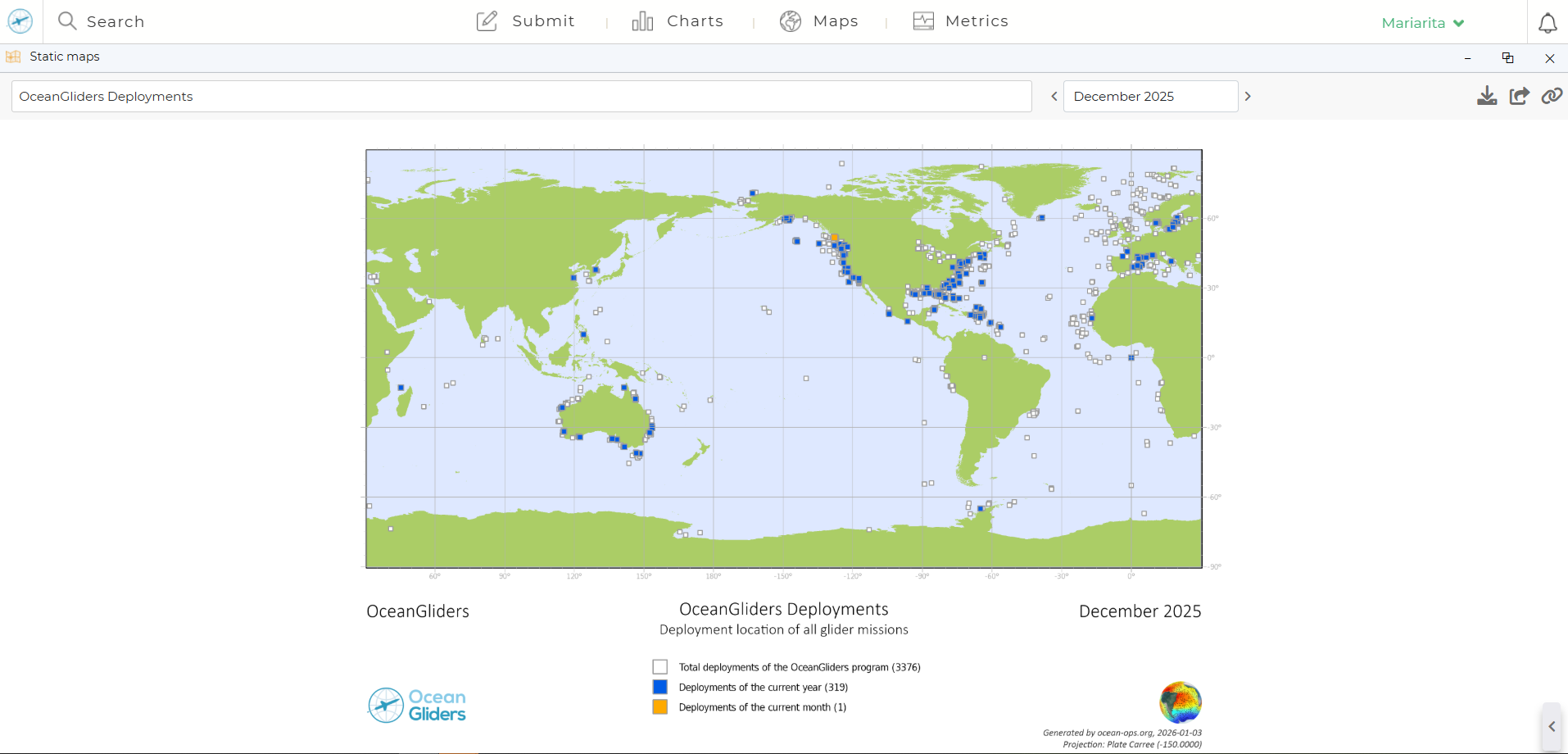
OceanGliders metadata at OceanOPS
The OceanOPS/OceanGliders dashboard provides a centralized framework for
collecting, standardizing, archiving, and distributing ocean gliders metadata.
maps and Figures to observe the real-time state of the Network
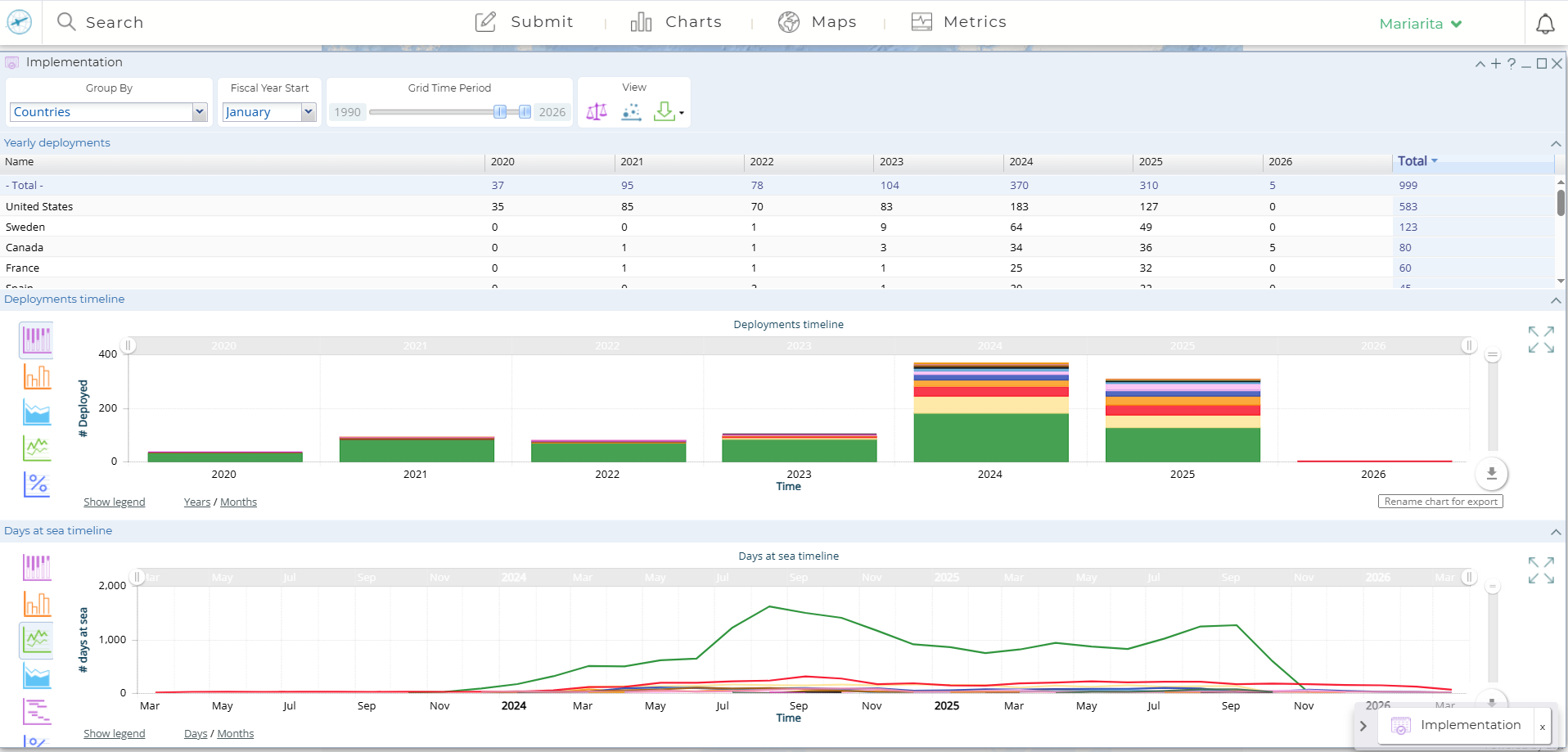
OceanOPS provides a centralized operational platform that supports the global ocean observing community by delivering real-time monitoring, coordination, and reporting tools.
Through its interactive dashboards and mapping services, users can:
-
access up-to-date information on the status and distribution of
observing networks, including gliders -
retrieve tailored statistics on deployments, activity levels,
and system performance.
OceanOPS enables users to visualise their own contributions, generate network summaries, and track implementation progress, facilitating coordination, transparency, and informed decision-making across the global observing system.